There are 7 campgrounds and
14 backcountry campsites within the Great Smoky Mountain National Park. This page will only cover vehicle accessible campgrounds located within
the park. Use this
park map to locate the areas the campgrounds are in.
Campsites at Elkmont, Smokemont, and Cades Cove
may be reserved between May 15 - October 31st. For reservations call 1-800-365-2267 (park code GRE) or
visit the National Park Service reservation web site at
http://reservations.nps.gov. Cades Cove and Smokemont campgrounds are
open year round. Every campground in the park has
restrooms with flush toilets, but none of the campgrounds have showers,
electric or water hook-ups. |
Cades Cove Campground:
Longitude: 35° 36.204'N
Latitude: 83° 46.53'W
Cades
Cove Campground Map
161 campsites open year-round. Probably the most popular campground in the Great Smoky Mountains
National Park. It provides bicycle or foot access to an
eleven mile, one-way loop road popular with
bicyclist, walkers, and runners. Cades Cove is also a good starting point for
backpacking and hiking trips.
|
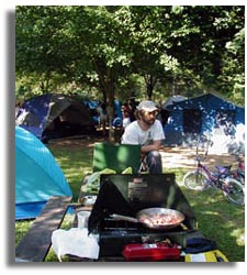
Camping in the Smoky Mountains |
|
Cades Cove has tent campsites, camping sites for RV's & trailers
and group camping. Also at this location is a ranger station, small store, restrooms, telephone, bicycle rental, horseback riding, dumping station and more.
|
|
Balsam Mountain Campground: no RVs
Longitude: 35° 33.948'N
Latitude: 83° 10.469'W
Elevation: 5,310'
Balsam Mountain Campground Map
|
|
Big Creek Campground:
Longitude: 35° 45.09'N
Latitude: 83° 6.582'W
Elevation: 1,700'
Big Creek Campground Map
|
|
Cosby Campground:
Longitude: 35° 45.366'N
Latitude: 83° 12.635'W
Elevation: 2,459'
Map Campground Map
|
|
Deep Creek Campground:
Longitude: 35° 27.659'N
Latitude: 83° 26.082'W
Elevation: 1,800'
Deepcreek
Campground Map
|
|
Elkmont Campground:
Longitude: 35° 39.354'N
Latitude: 83° 34.871'W
Elevation: 2,150'
Elkmount Campground
Map
|
|
Smokemont Campground:
140 campsite open year-round -
Longitude: 35° 33.471'N
Latitude: 83° 18.706'W
Elevation: 2,200'
Smokemount
Campground Map
|


