Southeastern Outdoors Obed River Tennessee
Southeastern Outdoors
Home > Public Lands > National Parks > Obed Wild & Scenic River
Free Shipping on Orders over $50Web Site Promotion
   

Obed Wild & Scenic River Whitewater Trips

Clear Creek at Obed Wild & Scenic RiverThe following is a growing collection of information about canoeing, kayaking or rafting in and around the Obed Wild & Scenic River in Cumberland and Morgan county Tennessee.

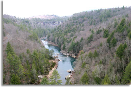
The Obed contains 4 waterways; Clear Creek, Daddy's Creek, Obed River and the Emory River.

Check the Obed maps and waypoints for directions and related information.
 

On-Line River flow gauges

 
From To Miles Avg Dif* Max Dif² Flow Min Op Max
Obed - Emory
Adams Bridge Potters Ford 4 III IV 1000 3000 5000
Potters Ford Obed Junction 12 II III 1000 3000 5000
Obed Junction Clear Creek Junction 4 III IV 500 1500 3000
Clear Creek Junction Nemo 5 II III 500 1500 3000
Clear Creek
U.S. 127 Bridge Barnett Bridge 20 II III 1500 2500 5000
Barnett Bridge Jett Bridge 5 II II 500 2500 4000
Jett Bridge Lilly Bridge 2 II III 800 2500 4000
Lilly Bridge Clear Creek Junction 2 III IV 1000 2500 3000
Daddy's Creek
Devils Breakfast Table Obed Junction 2 II II 700 1500 3000


* = Average difficulty indicates degree of difficulty of a section of river at optimum flow.

² = Maximum difficulty indicates the highest rated rapid in that section of the river at optimum flow. Flow information on most streams in east Tennessee is available from the Tennessee Valley Authority. Call (800)238-2264 and listen to the Emory at Oakdale recording.

 
Parking: there are good parking areas at the following locations -  Barnett Bridge, Jett Bridge, Lilly Bridge. All three area have pit toilets, Jett has a picnic table and changing station as well.
 
River Access Latitude Longitude
Adams Bridge N36°03.654' W084°57.685'
Barnett Bridge N36°07.348' W084°47.668'
     
Devils Breakfast Table N36° 3.581' W84° 47.483'
Jett Bridge N36°07.301' W084°44.737'
Lilly Bridge N36° 06.122' W84° 42.983'
Nemo    
Obed Junction    
Potters Ford    
U.S. 127 Bridge N36°10.225' W085°01.659'


Related Links & Resources:
Clear Creek Tennessee
● Obed River Plant Community Structure and Abiotic Conditions
Obed Wild & Scenic River Maps & Waypoints
Wild & Scenic Rivers Act of 1968
Rivers of the Wild & Scenic Rivers Act


National Parks
Obed Scenic River
Obed River Maps
Rock Climbing
Catoosa WMA
Cumberland Trail
Tennessee Parks
Tennessee WMA's
 
Sponsor Links
Dale Hollow Marina
Outdoors-411
 
What's This?
Related Links
Tennessee Cabins
Bed & Breakfast Inn
Campgrounds
 
Tennessee Maps