Southeastern Outdoors Backpacking in the Brooks Range
Southeastern Outdoors
  Home > Public Lands > State Parks > Savage Gulf State Park
Dale Hollow MarinaWeb Site Promotion
   

Savage Gulf State Park

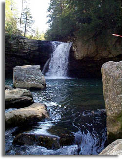
Savage Gulf State Natural Area encompasses 15,590 acres in Grundy and Sequatchie counties in middle Tennessee.
Stone Door Coordinates
Latitude: N 35° 26.383'
Longitude: W 85° 38.951'
Savage Gulf Map


Savage Falls, Tennessee
 
Camping:


Weather: The following table are average monthly temps and precipitation. Keep in mind these are averages. Winter can bring snow and weeks of below freezing temperatures. Late summers can be hot and dry making backcountry water scarce. Be prepared and plan ahead.

Month Precip Temp (f)
January 5.23" 41.6
February 5.11" 44
March 6.05" 50.7
April 4.53" 59.7
May 4.16" 67.7
June 4.21" 75.8
July 5.34" 78.3
August 3.7" 77.3
September 2.69" 72.5
October 3.24" 60.6
November 4.03" 49.1
December 5.31" 42.1


Directions:

Links & Resources:
  Savage Gulf trip Report
 •
Tennessee State Natural Areas
 •
 •
 •
 
 
State Parks
Savage Gulf Park
Center Hill Lake
Fall Creek Falls
Hiking forums
Paddling Forum
Camping
 
 
Sponsor Links
Dale Hollow Marina
Outdoors-411
 
What's This?
Related Links
Fishing Guides
US Campgrounds
Bed & Breakfast
 

Tennessee Maps