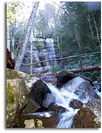
 The
Great Smoky Mountains National Park has 98 backcountry campsites, and 15
camping shelters. The
Great Smoky Mountains National Park has 98 backcountry campsites, and 15
camping shelters.
While all of the campsites are open to public use, ALL backcountry camping
DOES require a free camping permit. You will notice some campsites are for
specific users such as boat camping or horse camping.
Reservations are required for all backcountry campsites and shelters and can be
made by calling (865) 436-1231.
We also have a list of
Backpacking Trips in the
Smoky Mountain. |
| |
|
Site # |
Capacity |
Elevation |
| |
|
|
|
| Cooper Road |
1 |
|
1,200' |
| Cane Creek |
2 |
|
1,320' |
| Hesse Creek |
3 |
|
1,360' |
| Kelly Gap |
4 |
|
1,930' |
| Rich Mountain |
5 |
|
3,400' |
| Turkeypen Ridge |
6 |
|
3,400' |
| Ace Gap |
7 |
|
1,680' |
| Anthony Creek |
9 |
12, 4H |
3,200' |
| Ledbetter Ridge |
10 |
|
3,000' |
| Beard CAne |
11 |
|
1,530' |
| Forge Creek |
12 |
|
2,600' |
| Sheep Pen Gap |
13 |
|
4,640' |
| Flint Gap |
14 |
|
2,050' |
| Rabbit Creek |
15 |
|
1,550' |
| Scott Gap |
16 |
|
1,700' |
| Little Bottoms |
17 |
|
1,240' |
| |
|
|
|
| West Prong |
18 |
|
1,600' |
| Upper Henderson |
19 |
|
2,880' |
| King Branch |
20 |
|
2,520' |
| Medicine Brach Bluff |
21 |
|
3,780' |
| Camp Rock |
23 |
|
3,200' |
| Rough Creek |
24 |
|
2,860' |
| Dripping Spring Mtn. |
26 |
|
4,400' |
| Lower Jakes Gap |
27 |
|
3,520' |
| Marks Cove |
28 |
|
3,490' |
| Three Forks |
30 |
|
3,400' |
| |
|
|
|
| Ottercreek |
29 |
|
4,560' |
| Porters Flat |
31 |
|
3,400' |
| Injun Creek |
32 |
|
2,280' |
| Settlers Camp |
33 |
|
1,960' |
| Sugar Cove |
34 |
|
3,240' |
| Gilliland Creek |
35 |
|
2,680' |
| |
|
|
|
| Upper Walnut Bottom |
36 |
|
3,040' |
| Lower Walnut Bottom |
37 |
|
3,000' |
| Mount Sterling |
38 |
|
5,820' |
| Pretty Hollow |
39 |
|
3,040' |
| Big Hemlock |
40 |
|
3,100' |
| Caldwell Fork |
41 |
|
3,360' |
| Spruce Mountain |
42 |
|
5,480' |
| |
|
|
|
| McGee Spring |
44 |
|
5,040' |
| Enloe Creek |
47 |
|
3,620' |
| Upper Chasteen |
48 |
|
3,320' |
| Cabin Flats |
49 |
|
3,060' |
| Lower Chasteen |
50 |
15, 15H |
2,360' |
| |
|
|
|
| Newton Bald |
52 |
|
5,000' |
| Poke Patch |
53 |
|
3,000' |
| Nettle Creek |
54 |
|
2,600' |
| Pole Road |
55 |
15, 15H |
2,410' |
| Burnt Spruce |
56 |
|
2,405' |
| Bryson Place |
57 |
20, 12H |
2,360' |
| Nicks Nest Branch |
58 |
|
2,360' |
| McCraken Branch |
59 |
|
2,320' |
| Bumgardner Branch |
60 |
|
2,120' |
| |
|
|
|
| Bald Creek |
61 |
|
3,560' |
| Upper Ripshin |
62 |
|
3,160' |
| Jerry Flats |
63 |
|
2,920' |
| Mill Creek |
64 |
|
2,540' |
| Bear Pen Branch |
65 |
|
2,040' |
| Lower Noland Creek |
66 |
|
1,720' |
| Goldmine Branch |
67 |
|
1,840' |
| |
|
|
|
| Steeltrap |
68 |
|
3,960' |
| Huggins |
69 |
|
2,800' |
| Jonas Creek |
70 |
|
2,400' |
| CCC |
71 |
|
2,180' |
| Lower Forney |
74 |
|
1,720' |
| Poplar Flats |
75 |
|
2,800' |
| |
|
|
|
| Calhoun |
82 |
|
2,720' |
| Bone Valley |
83 |
|
2,280' |
| Sugar Fork |
84 |
|
2,160' |
| Sawdust Pile |
85 |
|
2,000' |
| Proctor |
86 |
|
1,680' |
| |
|
|
|
| Jerry Hollow |
87 |
Boats Only |
1,720' |
| Pinnacle Creek |
88 |
|
2,200' |
| Lower Ekaneetlee |
89 |
|
1,880' |
| Lost Cove |
90 |
|
1,760' |
| Upper Lost Cove |
91 |
|
2,040' |
| Upper Flats |
92 |
|
2,520' |
| Twentymile Creek |
93 |
|
1,880' |
| Dalton Branch |
95 |
|
2,360' |
| Eagle Creek Island |
96 |
|
2,880' |
| Big Walnut |
97 |
|
2,400' |
| Birch Spring Gap |
113 |
12, 6H |
3,680' |
| |
|
|
|
| Gunter Branch |
72 |
Boats Only |
1,720' |
| Kirkland Creek |
76 |
|
1,770' |
| Pilkey Creek |
77 |
|
1,800' |
| Double Island |
78 |
Boats Only |
1,720' |
| North Shore |
81 |
|
1,800' |
| Chambers Creek |
98 |
|
1,720' |
| |
|
|
|
| |
|
|
|
| |
|
|
|
| |
|
|
|
| |
|
|
|
|
| |
| |
|


